Hurricane Erin, the first major hurricane of the 2025 Atlantic season, has surged to Category 3 status, bringing heavy rain and dangerous surf to the Caribbean. With sustained winds of 125 mph as of August 17, 2025, Erin’s rapid intensification to a rare Category 5 on Saturday stunned meteorologists. Now moving north of Puerto Rico, it poses no direct threat to the U.S. mainland but could cause life-threatening rip currents along the East Coast. How will Hurricane Erin 2025 impact coastal regions? This article tracks its path and explores its broader implications.
Erin’s Rapid Intensification and Current Status
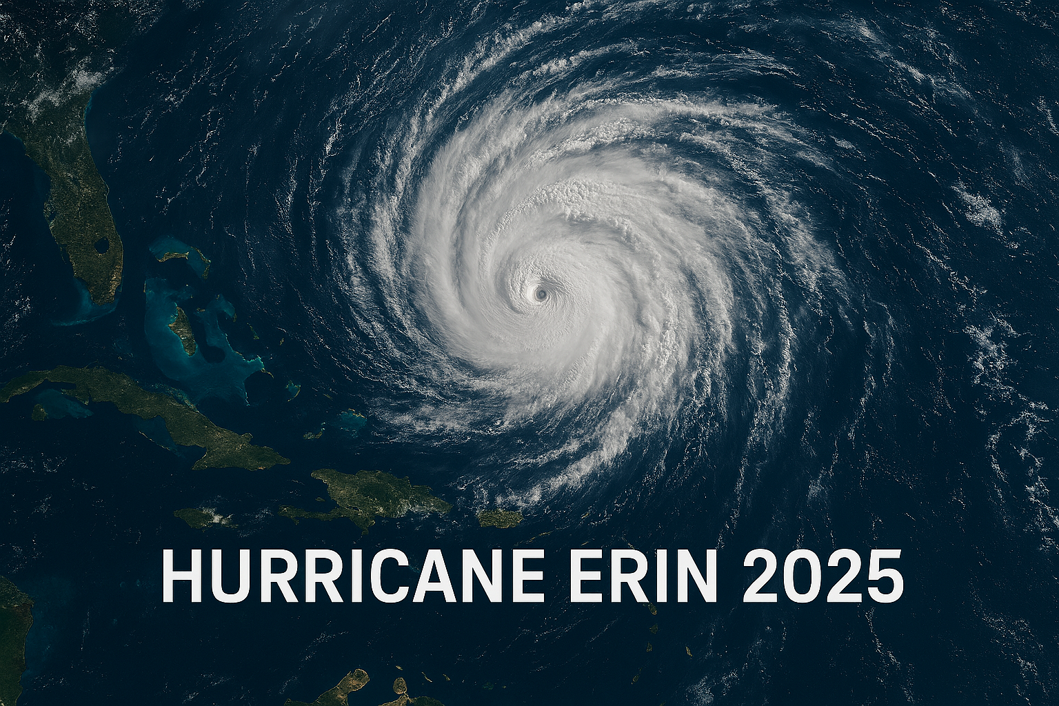
Hurricane Erin formed as a tropical storm on August 11 near the Cabo Verde Islands, becoming a Category 1 hurricane by August 15 with 75 mph winds. Within 24 hours, it escalated to a Category 5 with 160 mph winds, one of the fastest intensifications on record before September. By Sunday, August 17, it weakened to a Category 3 with 125 mph winds, undergoing an eyewall replacement cycle that could see it regain strength. Located 150 miles northeast of San Juan, Puerto Rico, Erin’s tropical storm-force winds extend 205 miles, impacting the Caribbean.
Path and Forecasted Trajectory
Erin is moving west-northwest at 14 mph, passing north of the Leeward Islands, Virgin Islands, and Puerto Rico. It’s expected to turn northwest on Sunday, then north by Monday, staying east of the Bahamas and hundreds of miles from the U.S. East Coast. By midweek, it will track between Bermuda and North Carolina, potentially doubling or tripling in size. Tropical storm warnings remain for Turks and Caicos and the southeast Bahamas, with no direct U.S. landfall expected. However, large waves and rip currents will affect coastal areas from August 20 to 27.
Impacts on the Caribbean and Beyond
Erin’s outer bands are drenching Puerto Rico, the Virgin Islands, and the Leeward Islands with 2-6 inches of rain, with isolated areas seeing up to 8 inches. This could trigger flash flooding, landslides, and mudslides. In Puerto Rico, downed trees and power poles were reported, with flash flood warnings issued until midnight Saturday. The U.S. Coast Guard closed ports in St. Thomas, St. John, and six Puerto Rican seaports. Dangerous surf and rip currents threaten the Bahamas, Bermuda, and the U.S. East Coast, with waves of 8-12 feet expected along North Carolina’s Outer Banks.
Context of a Warming Climate
Erin’s rapid intensification reflects a trend linked to global warming, as warmer sea surface temperatures fuel stronger storms. The Atlantic has seen 11 Category 5 hurricanes since 2016, with Erin marking the fourth consecutive season with such a storm. Typically, Category 5 storms form later in the season, making Erin’s early August peak unusual. The National Oceanic and Atmospheric Administration (NOAA) predicts an above-normal 2025 season, with 13-18 named storms, 5-9 hurricanes, and 2-5 major hurricanes.
Public and Official Reactions
The National Hurricane Center (NHC) urges residents in the Caribbean to monitor Erin closely, warning of life-threatening surf and flooding. Meteorologist Cassandra Mora noted that rip currents caused 12% of U.S. hurricane-related deaths over the past decade. On X, the NHC emphasized ongoing risks to Puerto Rico and the Virgin Islands, with posts urging coastal communities to prepare for dangerous surf. Local officials in the U.S. Virgin Islands closed National Park Service sites on St. Croix, reflecting heightened caution.
Broader Implications for Coastal Safety
Erin’s massive wind field and swell generation highlight the growing threat of indirect hurricane impacts. Even without landfall, its effects—erosion, rip currents, and coastal flooding—pose risks from Florida to New England. The NHC and NOAA stress preparedness, as August to October is the peak hurricane season. Erin’s early strength serves as a reminder for coastal communities to update emergency plans, especially given forecasts of increased tropical activity into September.
Hurricane Erin Key Facts
| Fact | Details |
|---|---|
| Current Status | Category 3, 125 mph winds, 205-mile wind field |
| Location | 150 miles northeast of San Juan, Puerto Rico |
| Path | West-northwest, turning north, between Bermuda and U.S. East Coast |
| Impacts | 2-8 inches of rain, flash flooding, landslides, rip currents |
| Warnings | Tropical storm warnings for Turks and Caicos, southeast Bahamas |
| Climate Context | 11th Category 5 since 2016, fueled by warm sea temperatures |
Conclusion
Hurricane Erin 2025, the Atlantic’s first major storm this season, underscores the increasing intensity of hurricanes in a warming world. While sparing the U.S. mainland, its impacts on the Caribbean and coastal surf hazards demand vigilance. As the season peaks, communities must prioritize safety and preparedness.